I’ve had a Garmin GPS mounted to my bikes since before the Edge series of bike-specific computers was available, using their hiking models and the bike bar adapters to fashion computers that were functional but not particularly slim. (I’ve saved my ass with a mapping bike computer on several occasions, including trips to road ride in Beijing, mountain bike in the forests of Louisiana and poking around in the Netherlands. In fact it was a Garmin GPS computer that brought me to BikeHugger. Byron, who can’t stand the UI of Garmin devices was decrying the usefulness of an Edge model when I chimed in and schooled him on the value of a mapping-capable computer. The rest was history.
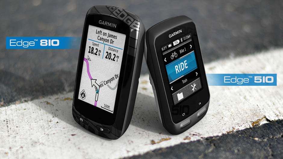
The new Garmin Edge 810 and 510 (announced today) add some great features (live weather, sync with iOS and more) but they’re still missing something I’ve been dying to get in a bike computer for years—the ability to customize a training ride by answering a few questions.
Here’s an example—I often tack miles onto my rides to extend my training and I’ll randomly pick new roads and see where they go. Sometimes this is great, sometimes I end up doing 30 miles when I wanted an extra 5. Often I’m headed straight up a hill when I wanted a flat, fast ride.
A GPS-based bike computer knows the terrain. Like my mapping software in my car, it could easily pick routes and avoid others. What I want to be able to do is pick two point—staring point and end point—and then customize how many miles I want to ride to get from one to the other, and the terrain type.
For example, I want to ride from my house to one of my shops (four miles apart) but I want a 20 mile route to get there. Or, I’d like to start at my house and end up back at my house, but I want to climb 5000 feet during my ride, and I don’t care how long it takes me to do that. Want to do intervals? Great, give me a local hill and pace me up it to stay on track and then plot my cool down. Or maybe I want to go from my house to my shop but I want to avoid as many roads as possible that I’ve taken more than once.
Or, sometimes more importantly, I want a route home from my current location that doesn’t go over a mountain.
This came to me once when I was capping off a grueling 50 mile event ride with what my GPS told me was a nice 25 mile route back to my house but turned out to be an additional 3000 feet of climbing that I was just not prepared for. Even if the GPS had shown me the elevation profile of the chosen route I could have decided to scrap the route before I found myself granny gearing up a 20 percent grade.
This wouldn’t be hard to do, it’s a variation on the route avoidance calculations that car-based units already have. But it would be massively, massively helpful to me. I wouldn’t have to ride out with a encyclopedic knowledge of the mountains around my house (or in a new-to-me city) to get a climbing workout or blow up my legs after a training ride with a climb-too-far.
Please, future Kickstarters and gadget developers, add these features and convert my GPS from a passive device into a serious Sherpa-like route guide.
…We're riding townies, adventure, and mountain bikes. Find recommendations on our store page. As Amazon Associates we earn from qualifying purchases.