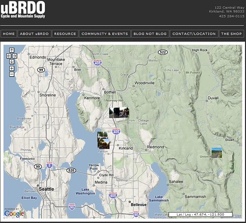
 Scotty over at uBRDO sent us a link to a new feature on his store site – a Google Maps Photo GeoLocator.
I did something like this a while back to associate latitude/longitude data with a Google map, then associate photos too it. The hard part? Getting Lat/Long associated with the photos in the first place. The ubiquitous iPhone. It uses triangulation software to approximate a location. I’ve used a GPS enabled camera, but again you face the limitations of line-of-sight. I’d love to build something like this for Vegas to photoblog the show, the ride, the race, and the social “ but in the mean time I’ll be checking out the adventures posted on Scott’s site.
…We're riding townies, adventure, and mountain bikes. Find recommendations on our store page. As Amazon Associates we earn from qualifying purchases.